


Assessing solar and wind energy resources for your next project
Prior to planning a wind or solar energy project, it is essential to determine where the abundant resource exists, understand the site’s meteorological characteristics, and validate the quality of available data. Our full-service resource assessment program is designed to provide your team with high-quality resource data, best practices in the design and implementation of measurement programs, rigorous quality control, and extensive validation and reporting on the data collection period. We work as an extension of your team and help you reduce uncertainties related to weather and climate.
Wind Resource Assessment
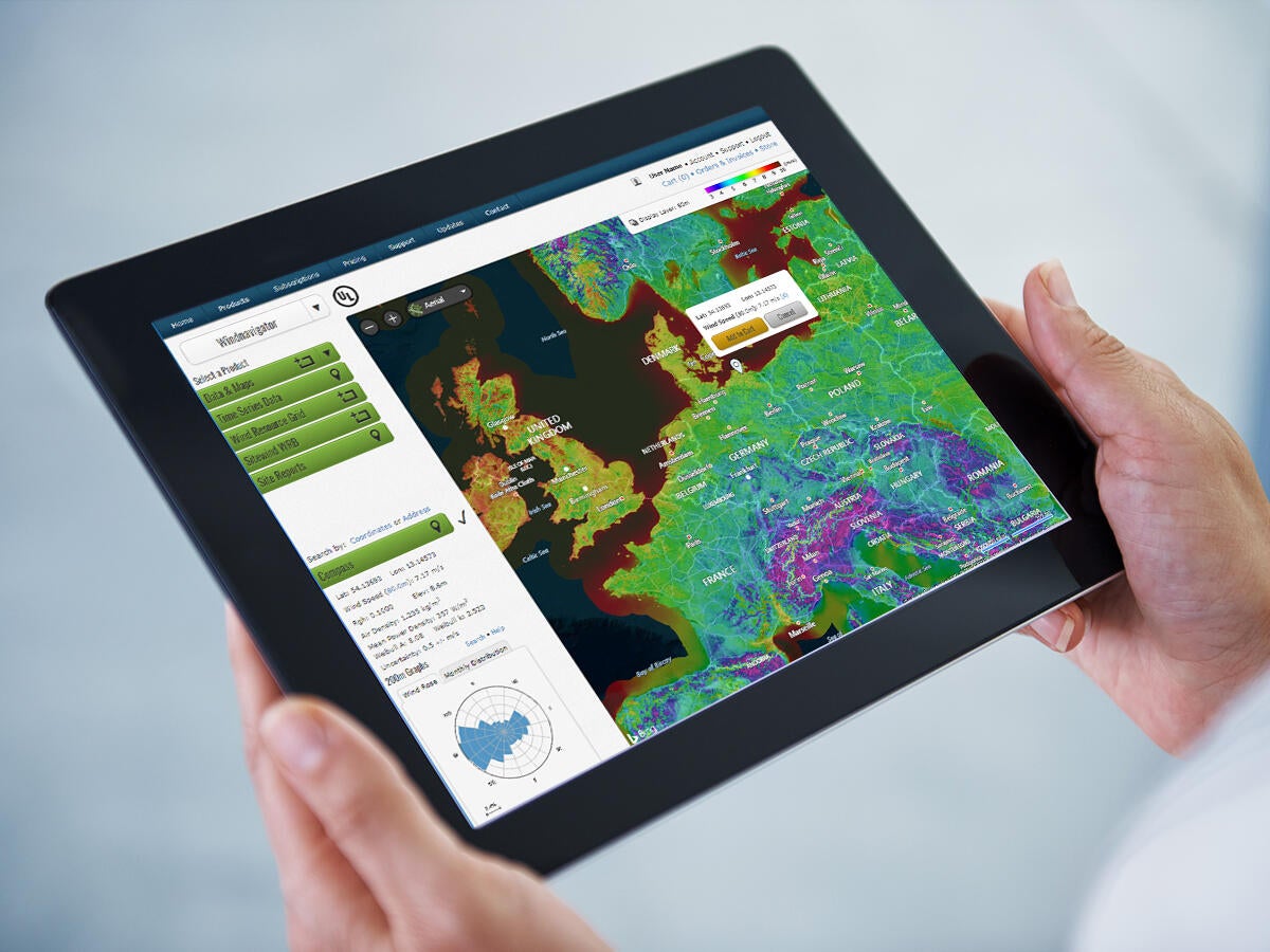
Wind resource maps and data
UL Solutions offers wind resource maps and data for all stages of project development. Our regional maps provide unmatched accuracy and detail in support of site prospecting and early-stage feasibility studies. Our micrositing maps use mesoscale and microscale models to achieve better accuracy than RANS CFD models. Other products include time series data sets and wind resource grids (WRGs). All of our maps and data are available through the Windnavigator dashboard and by custom order.

Wind measurement campaigns
The foundation of sound wind resource assessment is accurate measurements. Our engineers can design your wind monitoring campaign to fit your budget and priorities, and will arrange, oversee, and verify equipment installation to exacting standards. Our smart approach assures the greatest confidence for the smallest practical investment.

Remote sensing
Remote sensing systems can be a valuable complement to conventional measurements from tall towers, such as where hub-height tall towers are infeasible or too expensive. Our staff engineers are fully conversant in all types of remote sensing systems, including ground-based sodar, profiling lidar, and side-scanning lidar.

Wind data management and quality control
UL Solutions offers a comprehensive one-stop solution to managing your wind data safely and securely. We will collect the data, apply rigorous QC tests to detect problems such as malfunctioning equipment, and make data summaries and downloads available online through our Data Management Dashboard.
Resource analysis and reports
UL Solutions meteorologists are experts in analyzing wind resource measurements. We validate your wind resource data (including remote sensing), eliminate tower shadow and other problems, adjust for short-term climate and shear, and provide a summary or comprehensive report to support development decisions. Learn more
Renewable Resource Assessment Platform
The Renewable Resource Assessment Platform (RRAP) combines the methods, software tools and data resources required to conduct preliminary wind energy analysis into a web-based platform. RRAP is designed to follow the iterative process a wind developer takes to assess energy in the early stages of project development from greenfield prospecting to preliminary project design. The result is a more streamlined approach to help you make informed decisions on which wind projects to develop and/or invest in.
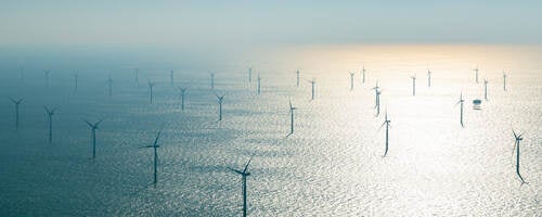
Offshore Resource Assessment
Resource maps and data
UL Solutions offers offshore wind resource maps and data for all stages of project development. Our regional maps provide unmatched accuracy and detail in support of site prospecting and early-stage feasibility studies. Our micrositing maps use mesoscale and microscale models to achieve better accuracy than RANS CFD models [reference]. Other products include time series datasets) and wind resource grids (WRGs).
Measurement campaigns
The foundation of sound wind resource assessment is accurate measurements. Our engineers can design your wind monitoring campaign to fit your budget and priorities, and will arrange, oversee, and verify equipment installation to exacting standards. Our smart approach assures the greatest confidence for the smallest practical investment.
Remote sensing
Remote sensing systems can be a valuable complement to conventional measurements from tall towers, such as where hub-height tall towers are infeasible or too expensive. Our staff engineers are fully conversant in all types of remote sensing systems, including floating and platform-based sodar, profiling lidar, and side-scanning lidar.
Data management and quality control
UL Solutions offers a comprehensive one-stop solution to managing your wind data safely and securely. We will collect the data, apply rigorous QC tests to detect problems such as malfunctioning equipment, and make data summaries and downloads available online through our Data Management Dashboard.
Resource analysis and reports
Our staff meteorologists are among the most experienced in the world when it comes to analyzing wind resource measurements. We will validate your data (including remote sensing), adjust for short-term climate and shear, and provide a summary or comprehensive report to support development decisions.
Solar Resource Assessment
Resource estimation
UL Solutions offers solar resource estimates for all stages of project development. We use a combination of satellite data and surface measurements to produce accurate and detailed estimates for site screening and feasibility studies as well as full-diligence irradiance analyses. Time series data sets are available for modeling plant energy output.
On-Site Meteorological Measurements
Increasingly, solar PV projects are relying on on-site meteological measurements to improve the accuracy of solar resource estimates. UL Solutions has over 10 years of experience with on-site measurement collection, and is one of the industry leaders in specifying equipment, maintaining measurement quality, and finalizing long-term estimates from on-site data. Our engineers can recommend equipment and best practices designed to support your project priorities. We will arrange, oversee, and verify equipment installation in view of industry standards. Our exacting approach assures the greatest confidence for the smallest practical investment.
Data management and quality control
UL Solutions offers a comprehensive one-stop solution to accessing and viewing your on-site solar data on a regular basis. Our team applies scrutiny and calibrated QC tests to detect problems such as malfunctioning equipment for timely resolution.
Resource analysis and reports
Our team of meteorologists and engineers is highly experienced in analyzing solar resource measurements. We will validate your data, adjust to long-term site conditions, and provide a comprehensive report to support stakeholder discussions and development decisions.
Get connected with our sales team
Thanks for your interest in our products and services. Let's collect some information so we can connect you with the right person.
Related services
- Renewable Energy Site Screening and Feasibility
- Wind and Solar Resource Measurement Campaigns
- Remote Sensing for Onshore and Offshore Wind Speed Measurement
- Wind and Solar Project Design and Energy Assessment
- Renewable Energy Technology Selection and Suitability
- Renewables Environmental and Permitting
- Renewable Energy Project Development Support